
Summer 2011
West Yellowstone, MT/Yellowstone National Park
15 June 2011
Local Map
Click on pinpoints for local information
Photographs and Commentary
Click on picture to enlarge
The next two days are devoted to organized tours of Yellowstone National Park. To say that we can use two days to "tour" this park is an overstatement. The park covers 2,221,766 acres or 3.472 square miles (larger than Rhode Island and Delaware combined). Straight line distances are 63 miles north to south and 54 miles east to west. 93% of the area is what is called "back country" or undeveloped. The remaining 3% consists of the road system and lodges, campgrounds and visitor's centers.
The central road system in Yellowstone National Park is laid out like a figure eight running north to south. The figure eight has roads connecting it to the five entrances to the park. The northern part of the figure eight is know as the Upper Loop and the southern part is the Lower Loop. Yellowstone, established on March 1, 1872 is the world's first National Park. It exist by virtue of its geology, which was so unique that it prompted Congress to pass legislation that established the Park. The park is geologically active area, most people know about its geysers, most notably Old Faithful. However, the geysers would not exist were it not for the hot spot, a dome of magma that underlies the southwestern portion of the park. That area is the world's largest active volcano which last erupted about 600,000 years ago and blew out 1,000 times more debris and ash than the Mount St. Helens eruption in 1980.
Today's tour took us clockwise around the Upper Loop. We were the first pickup stop in for the tour bus and after we picked up other visitors from various hotels in town we entered the park via the West Entrance (4 blocks from the Yellowstone Grizzly RV Park). The entrance road, which parallels the Madison River, took us to Madison Junction where we followed a segment of the Lower Loop clock wise to Norris Junction. We then turned onto the Upper Loop for a clockwise run back to Norris Junction and then back to the West Entrance via Madison Junction. Our major stops included Gibbon Falls, Mammoth Hot Springs, Tower Falls, Canyon Village (including a side trip to view the Upper and Lower Falls of the Yellowstone River from the Rim of the Grand Canyon of the Yellowstone). Other stops depended on the proximity of wildlife to the road and access to safe parking off the road. The only major sightings were bisons and elk.
It was a long day, beginning at 8am and returning at 5pm. The weather was cool but the sun was shining. It was a great tour.
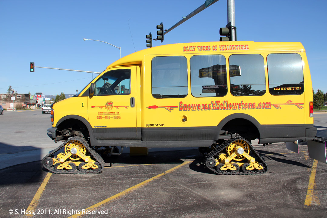
Our Transportation
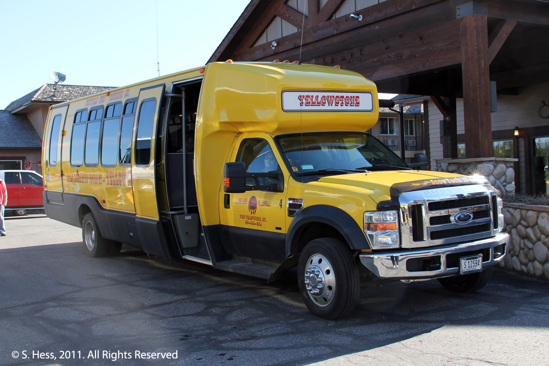
This is the tour bus we rode in today. In the winter, it is fitted with tracks like the smaller bus to the right. Winter tours in the park can only be done with snow vehicles like these, snowmobiles and snow cats.
Animals
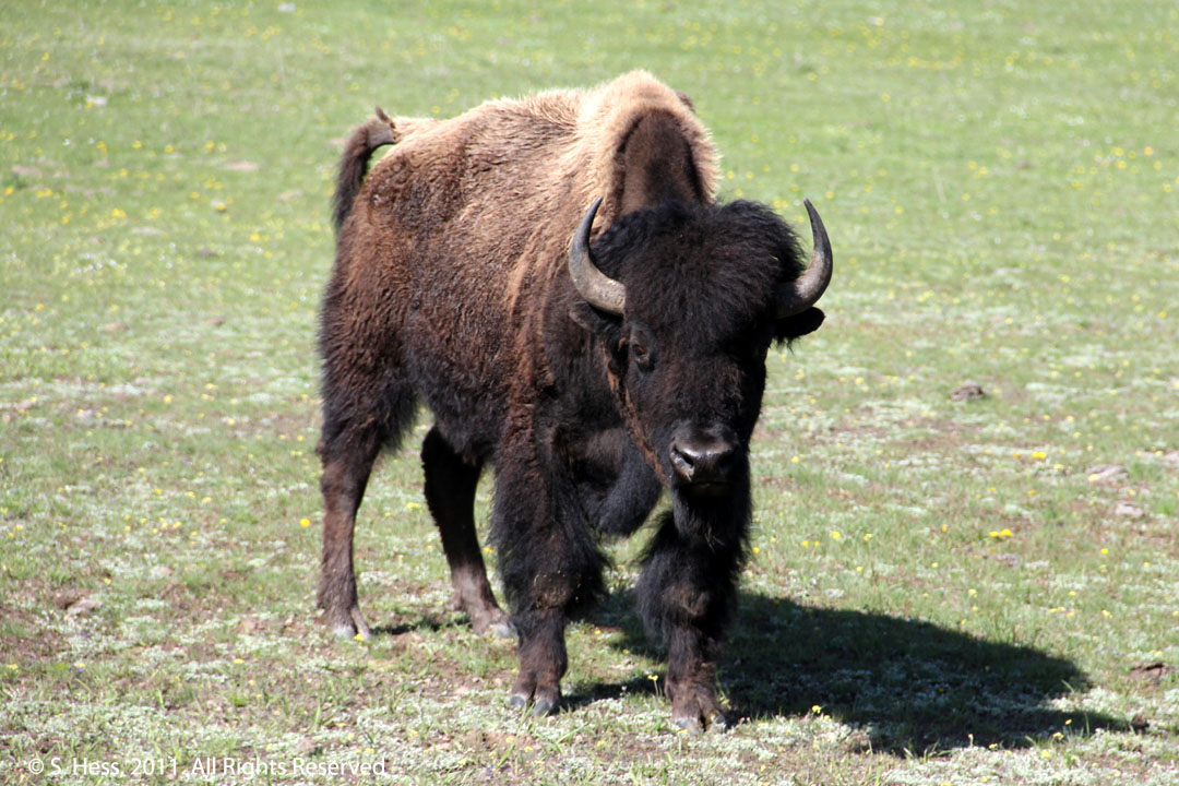
Bison (aka Buffalo)
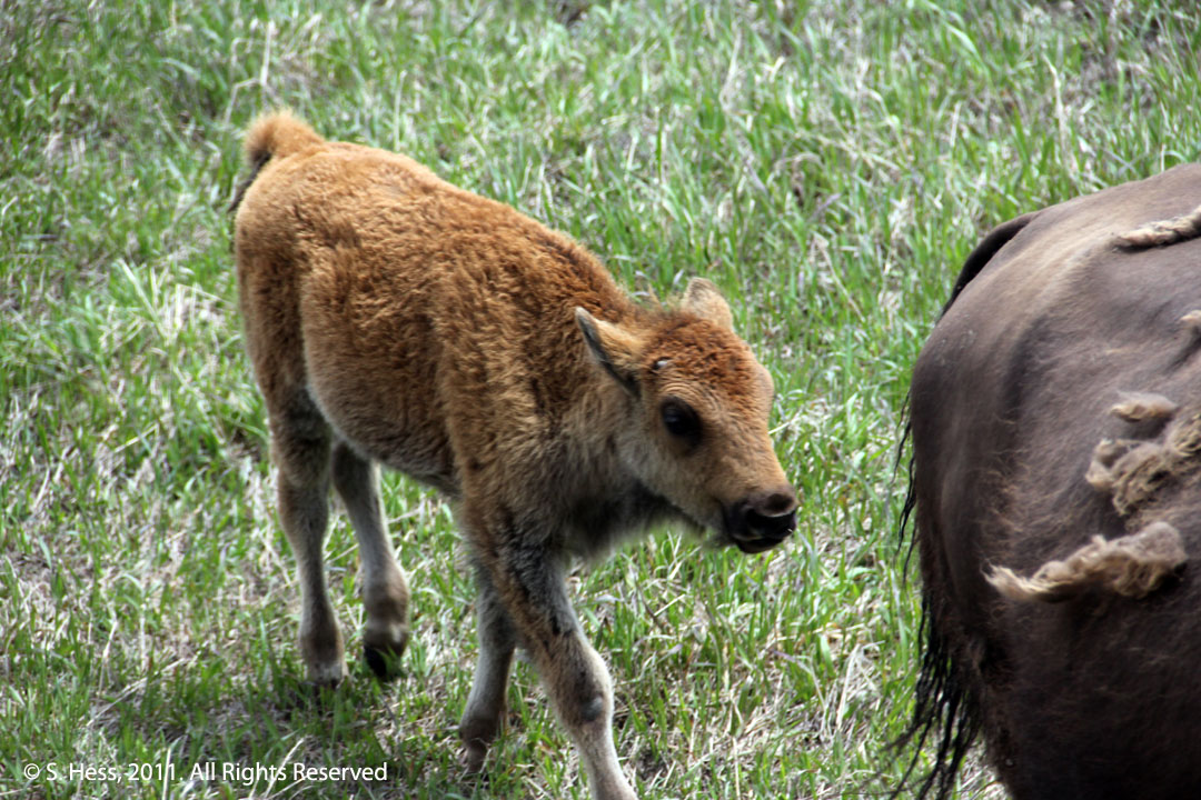
Bison calf with cow. This calf is only a few weeks old.
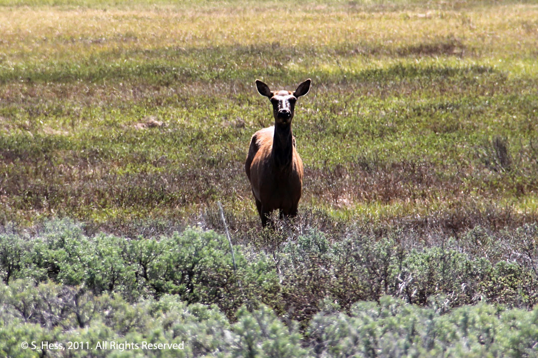
Elk cow
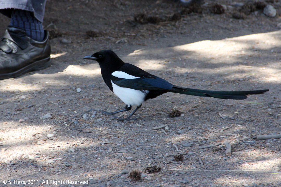
Magpie (or as some refer to it, a crow in a tux)
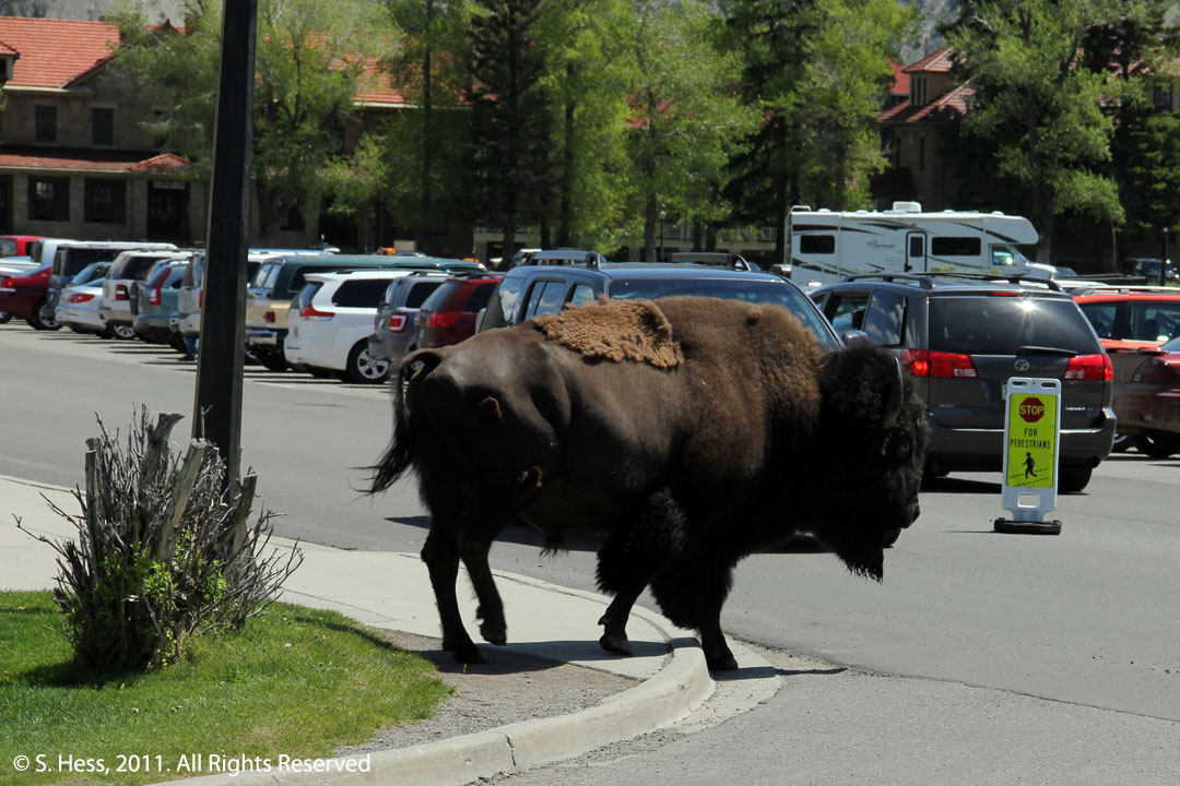
This could have been a very bad scene. This bison bull with an injured right rear leg found itself in Mammoth Hot Springs surrounded by buildings and people. Susie and I were sitting at a picnic table, 50 ft from where the bull is in this picture. We heard a commotion and took shelter behind a tree. Park employees were trying to herd the bull to an area away from people and not long after I took this picture the bull stopped in a area about 200 yards from us and we continued to have our lunch. Incidentally, the biggest cause of fatalities in the park is attacks by bison.
Yellowstone Scenes
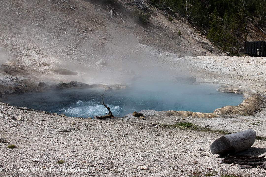
Beryl Spring
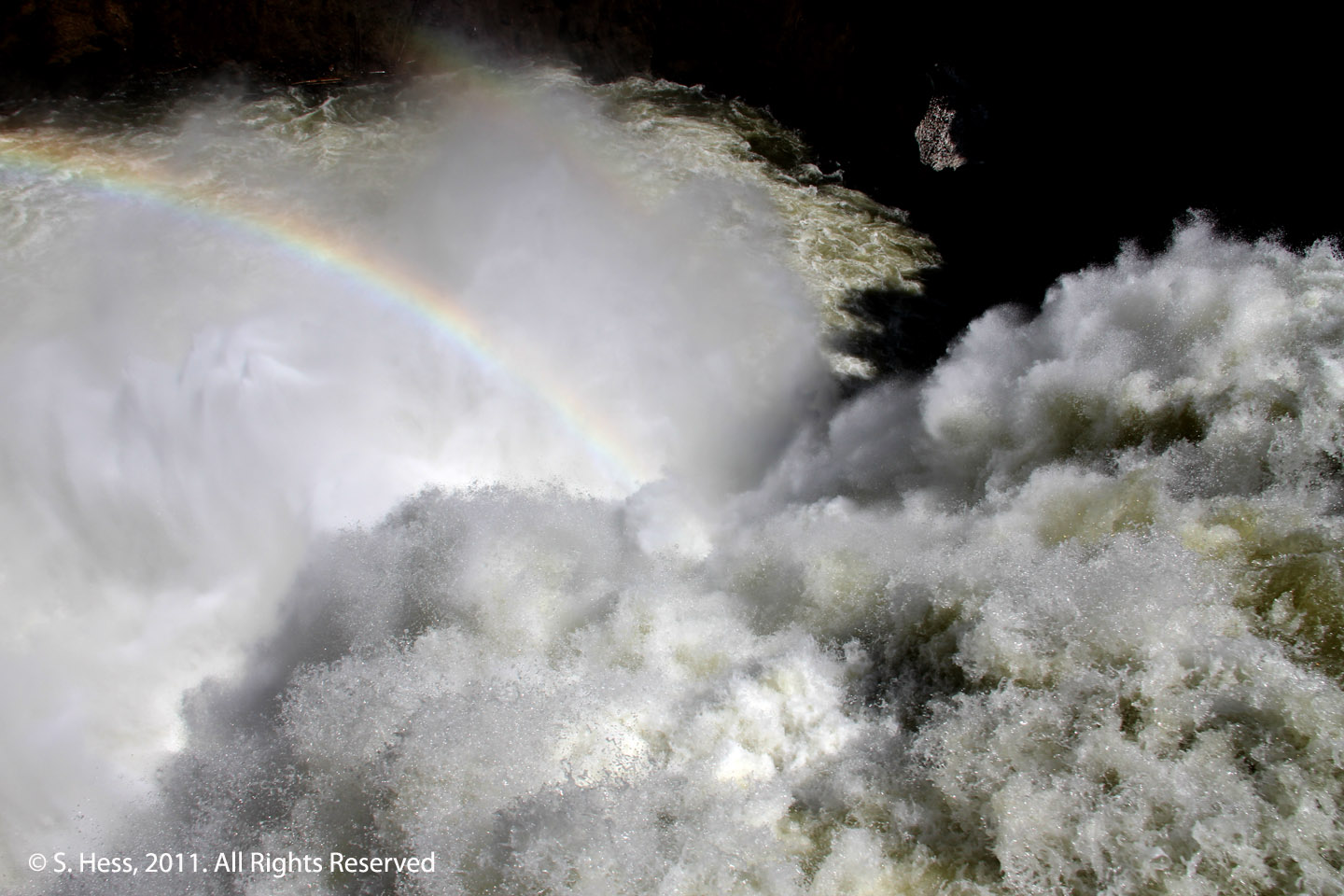
Brink of Upper Falls of the Yellowstone River
Gibbon Falls
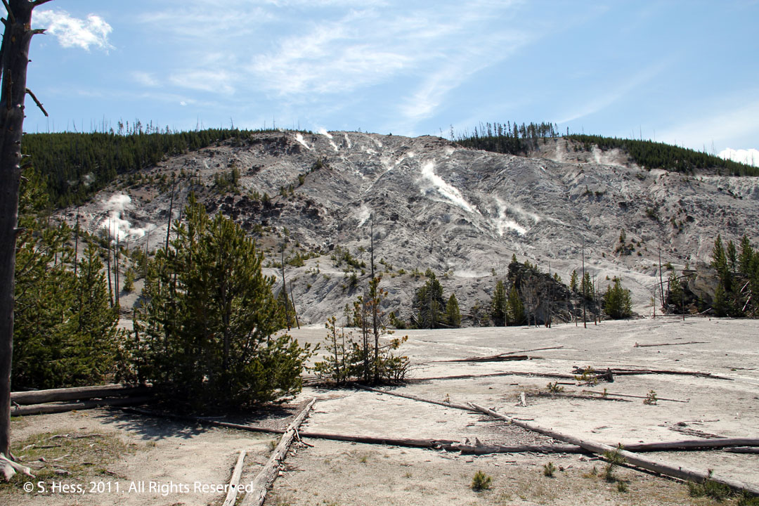
Roaring Mountain
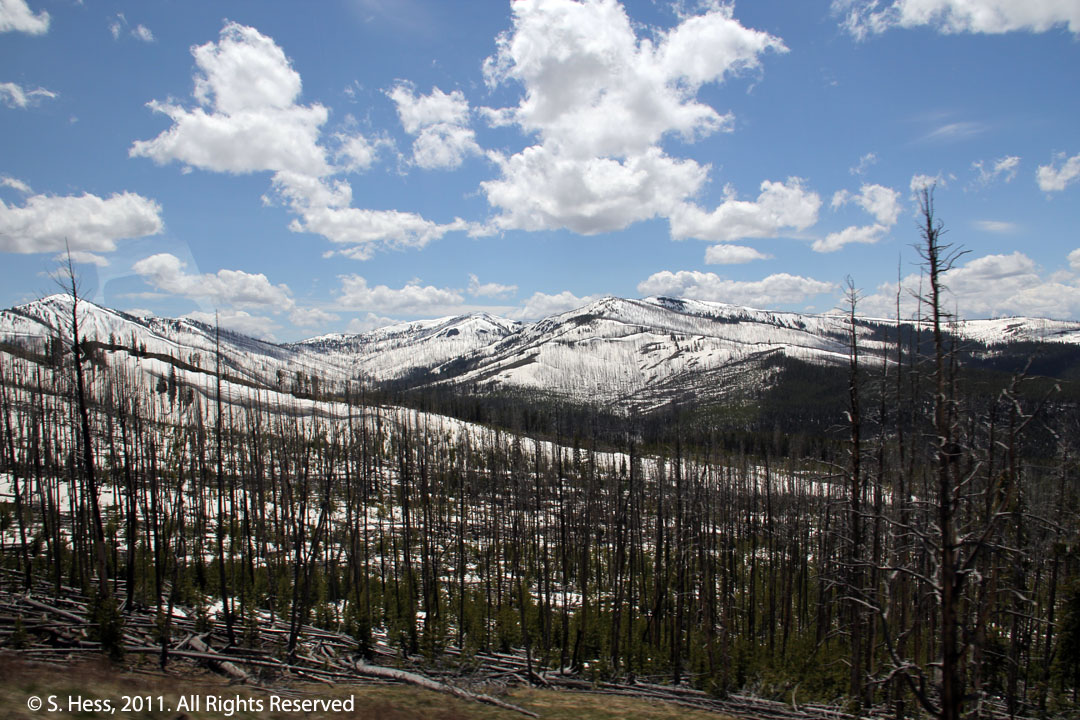
The snow cover was unusual for this time of the year.
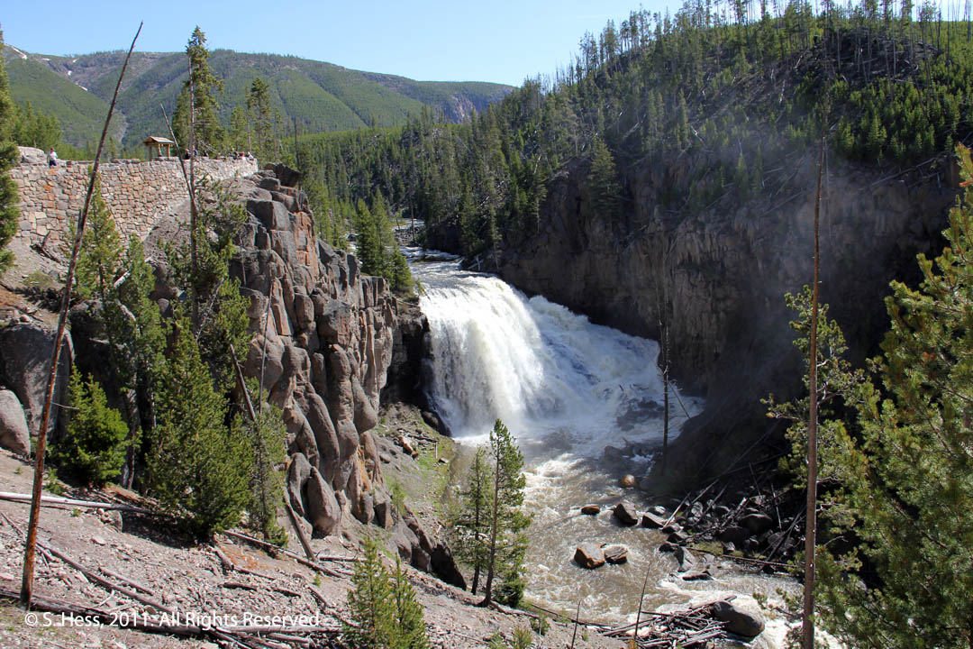
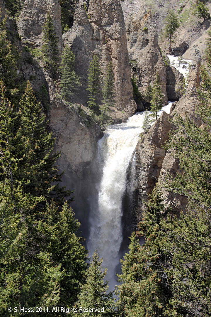
Tower Falls
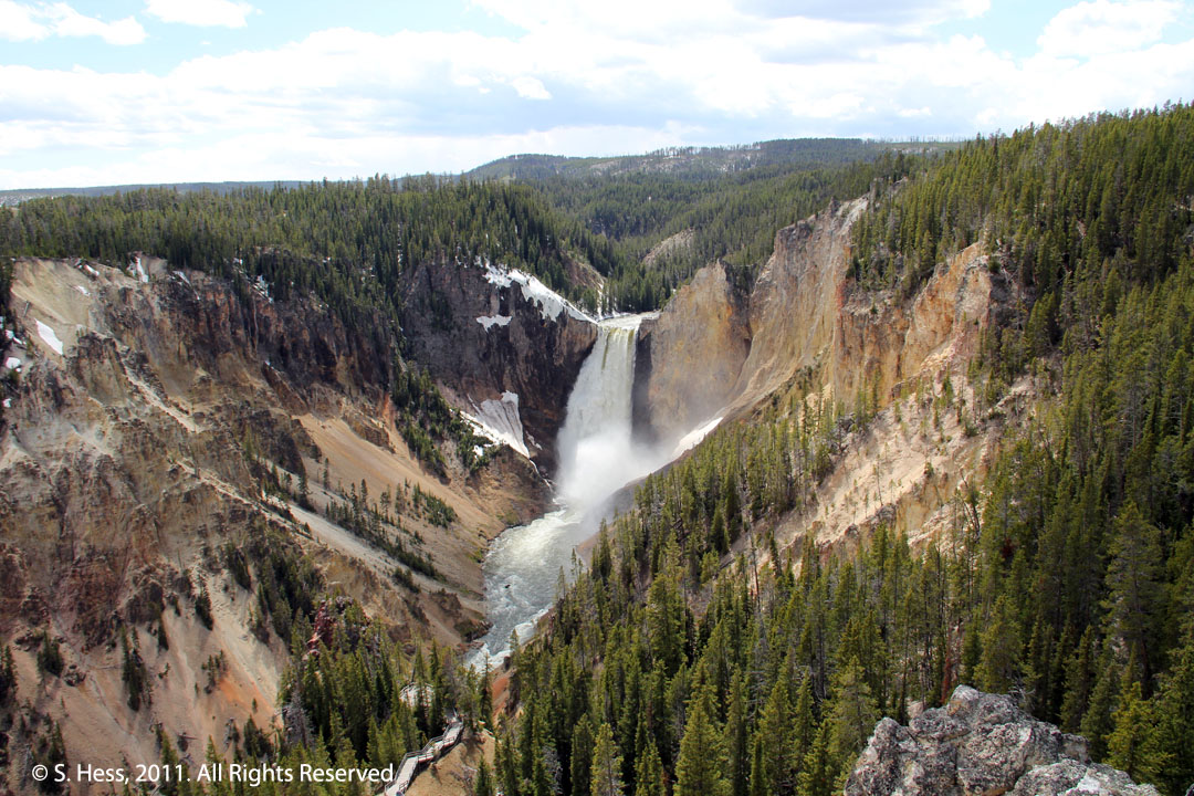
Lower Falls of the Yellowstone River viewed from Lookout Point
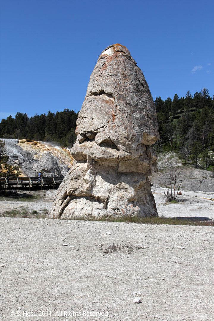
Right, Liberty Cap at Mammoth Hot Springs, a dormant hot spring cone. Can you see the cap and face?
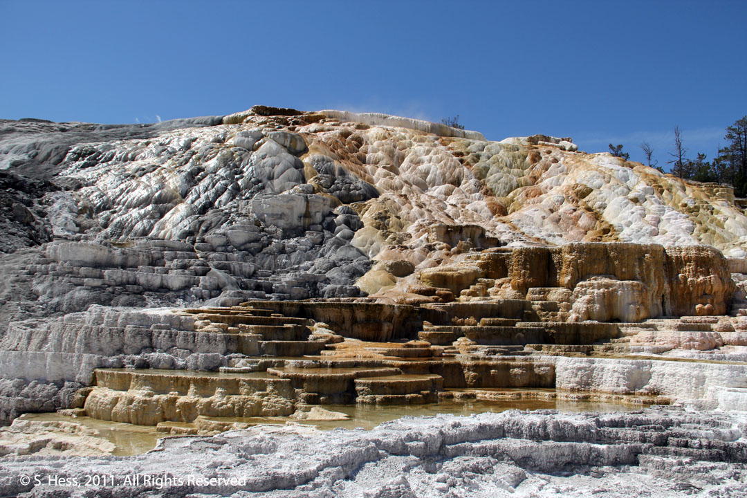
Palette Spring. The colors are not mineral deposits... they are produced by living things, extremophiles and thermopiles.
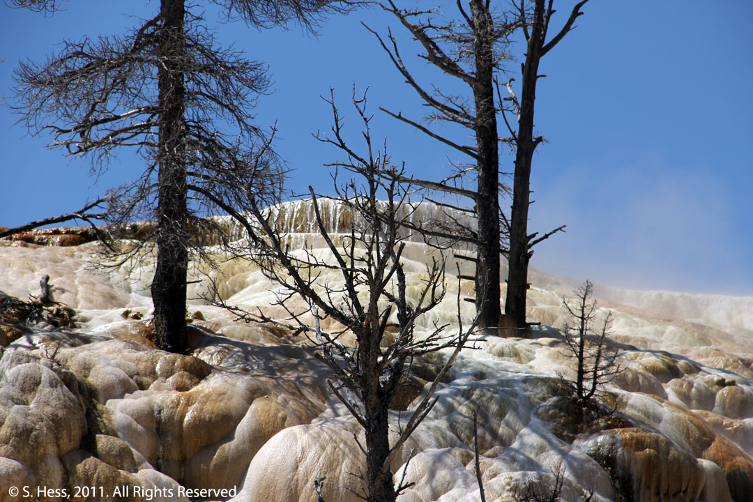
The trees at Palette Spring were alive only a few years ago. The deposits of Calcium Carbonate and hot water killed them.